A Travel Photographer’s Guide to Olympic National Park
Last updated: August 19th, 2024
Overview
Washington’s Olympic Peninsula (which includes Olympic National Park) is probably my favorite place in the world to explore and photograph. I’ve taken about 20 separate photography trips out to the Peninsula and could easily spend several more decades wandering around there without getting bored. With wild coastline, temperate rainforests, and glaciated mountains, it’s one of the most naturally-diverse regions on the planet, all in an area smaller than Los Angeles County.
This is a travel photographer’s guide to the Olympic Peninsula and Olympic National Park. It is—and will always be—a work in progress, updated as I continue to explore and photograph the region.
Highlights
Most travel guides for Olympic National Park recommend a similar selection of places, and for good reason. On a short trip, you can get a nice overview of the park’s diverse environments and quickly see the coast, rainforest, and mountains within a couple days. I’d highly recommend getting a little off-the-beaten path, but you can’t go wrong visiting the following iconic spots on a loop around the Peninsula: Hoh Rainforest, Ruby or Rialto Beach, Lake Crescent, and Hurricane Ridge. These are all popular locations though, especially during summer, so you’ll find alternatives below if you want to escape the crowds while having similar experiences or just dive even deeper into the region.
When to Visit
I’ve spent a considerable amount of time exploring and photographing Olympic National Park and the Olympic Peninsula during all seasons and conditions. It can easily be a year-round destination, especially if you’re comfortable in cold and rainy weather. That said, I think there are certain times of year that are going to give you the best chance of having a good time and coming home with nice images. The Peninsula is one of the rainiest places in the country, but it’s very unevenly distributed by season. Winter can see a tremendous amount of rain, spring and fall are a mixed bag, and summer is surprisingly dry.
Spring (late April through June or so) is a wonderful time to explore the Peninsula’s temperate rainforests. Personally, I’m a fan of photographing rainforests when it’s raining (or at least overcast) and the fresh new growth this time of year is extremely photogenic. July through September (and possibly into October) is a great time to explore into the mountainous center of the Peninsula. Snowpack differs by year and some areas will be snow-free in June as well, especially on the drier northeast side. Summer is surprisingly dry, with many cloudless days, which is wonderful for traveling, but can be difficult for photography. It’s also the most crowded time of year, but there are always ways to get off the beaten path and escape the bulk of the crowds. Fall (late September through early November) is probably my favorite time to visit the area, with the maple trees adding color to the rainforest scenes and the welcome return of some clouds and precipitation. Winter is beautiful, but can be more challenging to explore and photograph; lowland snow is rare, but driving up to Hurricane Ridge allows for easily-accessible winter mountain photography.
The coast is beautiful year-round. In the winter, you’ll likely experience stormy weather and extreme tides. Spring and fall on the coast can be beautiful with amazing sunsets. Summer is likely to be very foggy on the coast, which I find beautiful as well.
Overall, if I had to pick, I’d recommend visiting in May or October, unless you’re wanting to go deep into the mountains (then summer is best), but it’s hard to go wrong.
Park Passes
To make things easy, I’d recommend grabbing an $80 annual America the Beautiful national parks pass before heading out to the Peninsula. This will work for all of the sites within the National Park, as well as the national forests, the Dungeness National Wildlife Refuge, etc. Some of the areas don’t require one, but it’s usually worth having just so you don’t have to worry about it. The Washington State Parks Pass is $30 for the year and will be required at state parks, but you can very easily do a trip out to the Peninsula without that. Cape Flattery and Shi Shi Beach require going to the Makah Reservation, which requires that visitors buy a $20 annual recreation pass. Since I’m a local, I just always have current passes for all of these places (plus Oregon) in my glove box so I’m good to go.
Camping and Lodging Recommendations
I typically find camping to be a good option for exploring the Peninsula. There are dozens of campgrounds in the area on federal, state, county, and private land. Within the National Park, my favorites (so far) are Mora, Kalaloch, Fairholm, and Deer Park. Some of the Park’s campgrounds are first-come-first-served year-round, while others take reservations in the high season. Note that none of the National Park’s campgrounds have showers, but some of the state, county, and private parks in the area have coin-operated showers that are available for anyone to use. More information about camping options in the National Park here: https://www.nps.gov/olym/planyourvisit/camping.htm
If you’re self-contained in a camper van or other vehicle, there are lots of national forest roads with pull-offs—some better than others—where you can spend the night for free. I do this pretty frequently to save the $20 or $30 that an official campsite will cost. You’ll find some good options on the iOverlander app.
There are a few places on the Peninsula with hotels, as well as National Park lodges at Lake Crescent, Lake Quinault, and Kalaloch Beach. I haven’t personally stayed in many yet (typically prefer camping), but you’ll find some decent options in Port Angeles and Forks, which also make for great bases from which to explore. A nice option might be to split your time between the two towns.
Backpacking is another option. I’ll discuss that in the next section.
Backcountry Logistics
The wilderness portion of the Olympic Peninsula (both inside and outside of the National Park) is absolutely massive and to truly explore the mountainous interior often requires multi-day hikes. For backcountry campsites within the National Park, you’ll need a permit ahead of time. The most popular sites (the orange ones on this map) have quotas to limit the number of campers, which generally means that you’ll want to book those trips as soon as the permits go live (typically on the morning of April 15th for the upcoming summer season). All other backcountry sites within the park still require permits, but since there’s no quota, you don’t have to worry about booking them until right before your trip. For more information about planning backpacking trips within the Park, including where to reserve permits, which campsites require bear canisters, and which coastal trails require timing the tide levels, check out this page: https://www.nps.gov/olym/planyourvisit/wilderness-trip-planner.htm. Backpacking in the wilderness areas outside of the park is usually much easier—just follow typical wilderness procedures, including proper Leave No Trace practices.
Safety
This is a wild place and you’re sharing the area with bears, mountain lions, and other humans. More information on how to stay safe here, but generally you shouldn’t worry. There have been no reported bear attacks in the history of Olympic National Park. I stumbled upon one in the Queets Rainforest and we scared the crap out of each other, but it immediately ran away and wanted nothing to do with me.
Most importantly, always tell someone where you’re going and when to expect you to be back. There’s not cell reception in many parts of the Peninsula.
Drones
No drones are allowed anywhere in Olympic National Park or any of the bordering wilderness areas, so I always leave my drone at home for trips out to the Olympic Peninsula. That said, you should be fine to fly in non-wilderness-designated National Forest areas, but please be respectful of the wildlife and other visitors.
Data Roaming
Random aside, but I’ve occasionally noticed my cell phone connecting to Canadian towers when I’m on the north coast of the Olympic Peninsula. So, just make sure your plan covers Canada or you have data roaming turned off.
Leave No Trace
Hey, let’s leave these places as good or better than we found them. Always good to have a quick refresher on the 7 Leave No Trace principles: https://lnt.org/why/7-principles/
Resources
LOCATIONS
For these locations, we’ll generally go counter-clockwise starting from the Port Angeles area and ending back around near Sequim. I’ve explored and photographed the Olympic Peninsula more than just about anywhere else, so this list will be comprehensive!
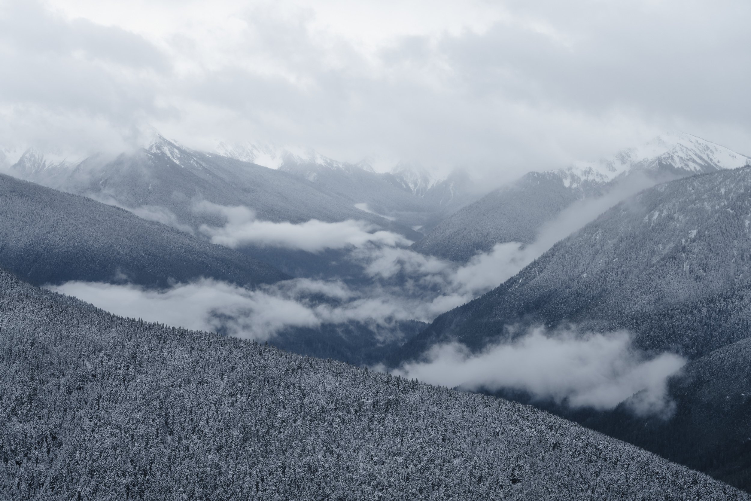
Hurricane Ridge
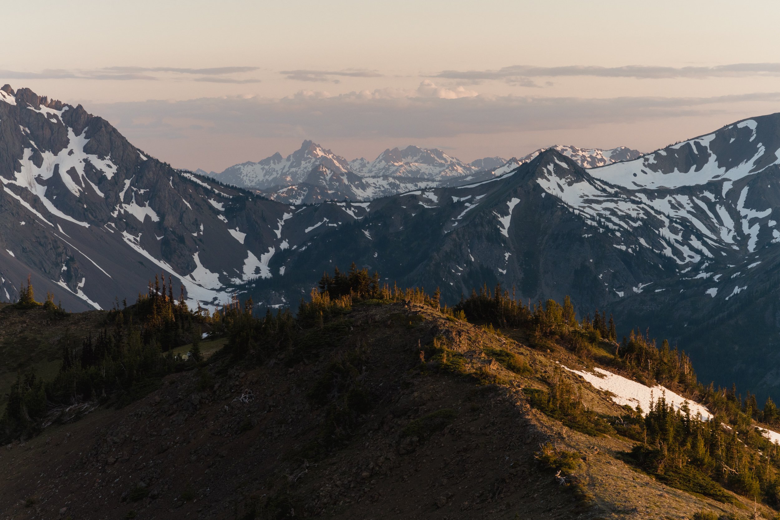
Hurricane ridge is the easiest location to get to for photographing and exploring the mountainous interior of Olympic National Park. The only paved road that goes up to high elevation will take you from the Port Angeles area up to the former location of the Hurricane Ridge Visitor Center (unfortunately, this building burnt down in a fire in 2023). From up here, you get wide open vistas of the rugged Bailey Range, the North Cascades, and even Vancouver Island. Several hikes, including Hurricane Hill, start from up here, but there are photo opportunities right from the parking lot too. The road is generally open year-round, but check this page for the current winter logistics (likely open a few days per week, requiring tire chains, etc.).


Obstruction Point Road
This little dirt road forks off of the main paved road right before reaching the Hurricane Ridge Visitor Center and takes you deeper into the mountainous interior. There are stunning viewpoints along the way, and several hikes start at the road’s end. Obstruction Point Road is typically open in the summer and fall. See this page for current status. While not a secret, I still think this road is still one of the underrated gems of Olympic National Park.


Tongue Point
Tongue Point is a coastal area within Salt Creek Recreation Area just west of Port Angeles on the Strait of Juan de Fuca. At low tide, this is one of the best tide pool viewing spots (starfish, sea urchins, shellfish, etc.) on the Olympic Peninsula. Views stretch north to Canada’s Vancouver Island. Also worth checking out: old relics from a WWII fort. Camping available, details here. I haven’t camped there, but it seems like there are some nice sites to the west within the trees. There’s also a fairly nice private campground and beach just to the west that we enjoyed camping at.


Lake Crescent
You’ll likely drive past Lake Crescent at some point if you’re going through the Port Angeles area. It’s absolutely stunning and worth stopping at. There are some beautiful big leaf maple trees in the Fairholme Campground area, lots to photograph around Lake Crescent Lodge (a restaurant inside has decent food), and the lake itself is beautiful. Marymere Falls is a nice, short hike away. I somehow haven’t done it yet, but the hike to Mount Storm King is a classic.


Salmon Cascades
Right by the side of the road, this spot is worth visiting if you’re there in September or October, when coho salmon can be seen launching themselves out of the water up and over the waterfall. It takes patience to time the shot right, but it’s really satisfying to capture these flying fish in action.


Sol Duc Falls
One of the most iconic scenes from Olympic National Park—and the Pacific Northwest in general!—Sol Duc Falls is a stunning waterfall where the river splits into two or three (depending on the time of year) streams as it cascades off a cliff. It’s an easy hike and less than a mile from the car to the falls, so you likely won’t be the only one there. Still, if you’re in the area when this road is open (usually March through November), this is absolutely worth a stop.


High Divide and Seven Lakes Basin
This is a tough and long hike and is typically done as a multi-day backpacking trip. It’s also one of the most popular backpacking trips in the Park, so you’ll need to be ready to snag permits the minute they go live (typically the morning of April 15th for the upcoming summer). I did this hike in September and the huckleberry plants covering the mountainsides were stunning in their fall color (and also absolutely delicious). Starting from the Sol Duc Falls trailhead, it’s about 19 miles with 5,400 feet of elevation gain and typically done in 2 or 3 days. I did it in two, spending the night at Lunch Lake within the Seven Lakes Basin. More information about the trail here.


Beaver Falls
This is a hidden gem and right off the side of the road. It doesn’t show up on a lot of the “best hikes” lists for the area, since it barely qualifies as a hike, so not very many people know about it. That said, it’s quite a photogenic waterfall and worth a stop if you’re passing by.


Cape Flattery
Cape Flattery is the furthest northwest point of the lower 48 states. It’s on the Makah Reservation, so after arriving there, you’ll need to stop off at one of several locations around town to purchase an annual Makah Recreation Permit for $20 (works for an entire calendar year). I’d highly recommend visiting the museum and you can purchase a permit there while you’re at it. The Cape Flattery trail is short, but be prepared for some muddy sections. There are signs everywhere saying to stay on the main path, which is important to respect, but it does make the photography a little more difficult. Still, it’s an amazing area for landscapes and even wildlife photography. I’ve seen tufted puffins and a sea otter, but it’s also a good area for spotting whales occasionally as well.


Ozette Lake
Ozette Lake reminds me of the large lakes in Minnesota or Manitoba. I’ve just done a bit of kayaking around the main campground there, but for real paddling enthusiasts, this would be a great place to explore (and camp!) by kayak or canoe for a few days. Most visitors don’t get to this corner of the Park, so it’s a nice way to escape the crowds.

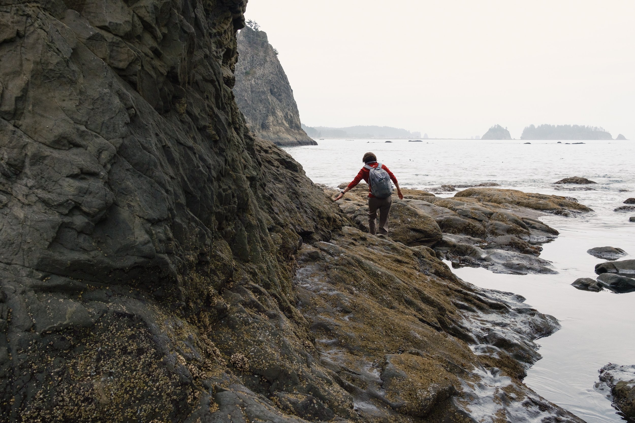
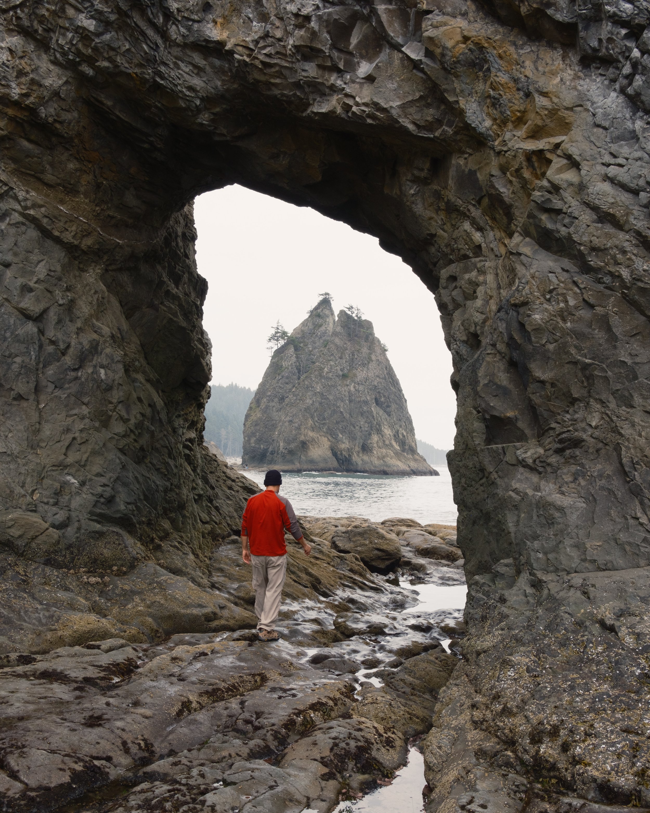
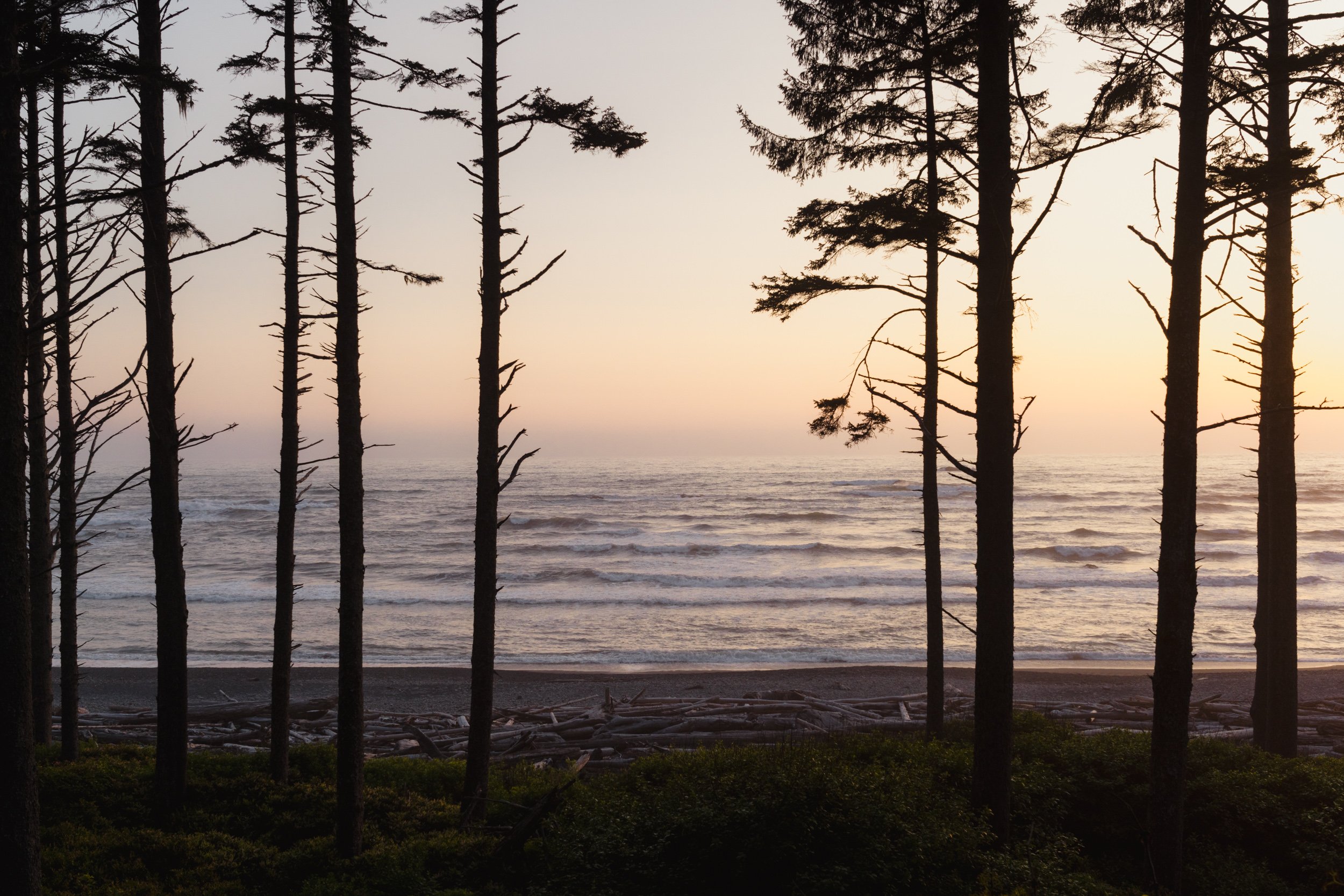
Rialto Beach
One of my favorite places in the world, I’ve spent quite a bit of time at Rialto Beach. You get to experience an amazing PNW beach scene right from the parking lot, and a fairly short hike north (time it for low tide) takes you to Hole-in-the-Wall, which is exceptionally photogenic. Keep an eye out for interesting driftwood patterns and wildlife too. I’ve seen everything from diving pelicans to river otters.


Second Beach
A nice hike through the forest takes you down to Second Beach. There’s an incredibly photogenic sea stack right off the coast and so many different possible compositions to play with. I’ve only been once, during some thick fog, but I’ll be back for a nice sunset someday soon.


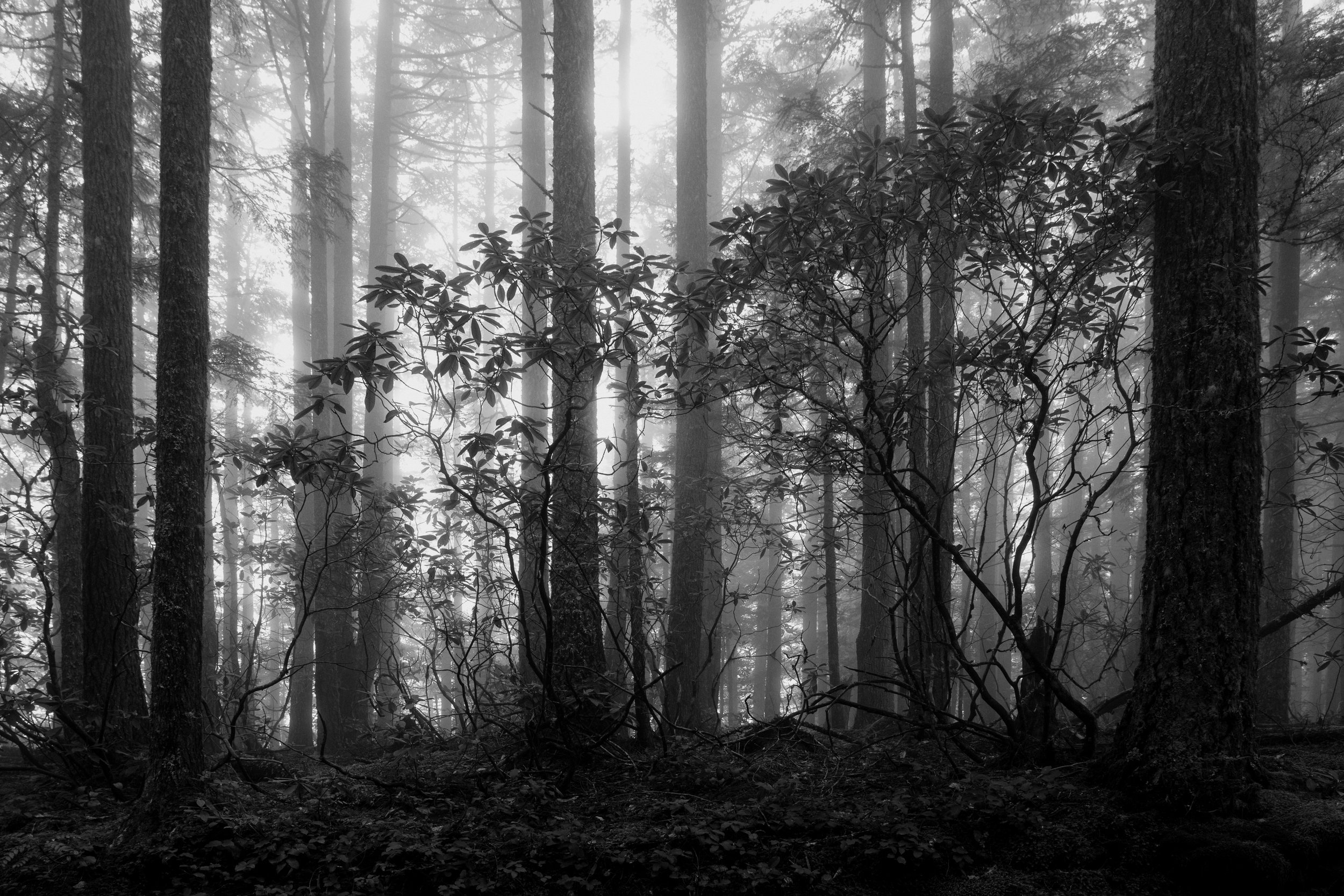
Bogachiel Rainforest
Now we’re getting into the wettest part of the park and the first of four temperate rainforest valleys. I’d say the Bogachiel Rainforest is the least popular of the four, but I’m honestly not sure why. You can go for miles and miles along the trail here, but I’ve only explored the first mile or so and found scene after scene to photograph. Truly a hidden gem of the Olympic Peninsula.


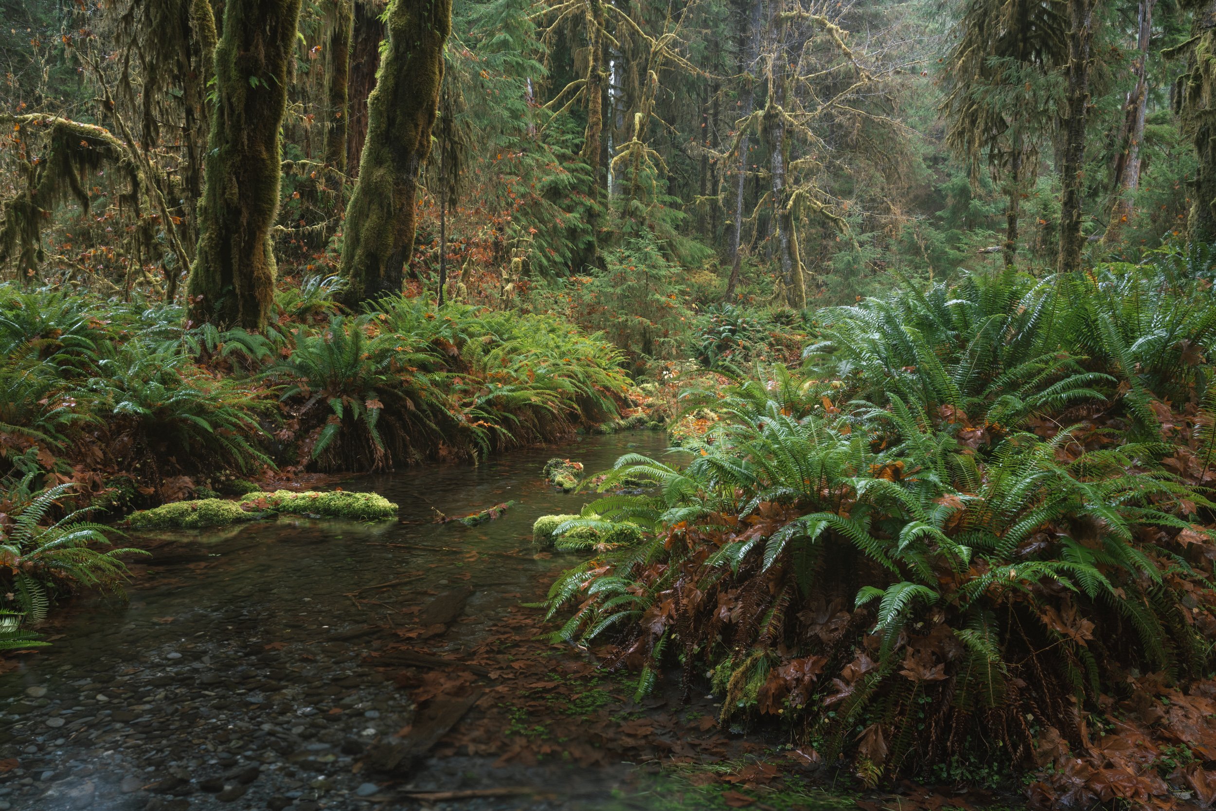
Hoh Rainforest
If you’ve seen any photos from Olympic National Park, you’ve surely seen one from the Hoh Rainforest. This is likely the most popular forest hike in Washington and it’s absolutely stunning. From the parking lot, you have three main options (though there are some amazing scenes along the road on the way in too, don’t miss out on those!). The Hall of Mosses Trail is the most popular, and absolutely worth doing, just please do stay on the trail since this is such a heavily trafficked area. Another short option that can easily be added on is the Spruce Nature Trail, which takes you right down to the Hoh River. I’ve found some of my absolute favorite photographs around here. Most people stick to one or both of these short sampler trails, but if you want to explore further, you can take the Hoh River trail just about as far as you want. That’s really the subject of the next section, involving a multi-day trek, but a 5.5-mile round trip hike to Mineral Creek Falls is a great option for a day hike.


Hoh River to Blue Glacier Trail
This was one of the toughest hikes I’ve done and my feet were so (so!) sore by the end. It’s about 40 miles round trip from the Hoh Rainforest Visitor Center to the foot of Blue Glacier on Mount Olympus and back. Most of those miles are flat, but there is a lot of elevation gain at the end. I did this in 3 days, but would recommend 4, with night one at Olympus Ranger Station or Lewis Meadow, night two at Glacier Meadows, and night three back at Olympus Ranger Station or Lewis Meadow. I hiked all the way out from Glacier Meadows on day 3, and that was a very, very long day. This is a bucket list level hike and the best way to get up close and personal with a glacier in Olympic National Park. You’ll need to get permits for these campsites as soon as they go live (typically on April 15th for the upcoming summer). This is not a trail to be taken likely, but it’s worth it if you’re up for some serious mountain exploring. For a look behind-the-scenes, I have a vlog from that trip on my YouTube channel that I’d recommend checking out.


South Fork Hoh Rainforest
Very much a hidden gem, this trail goes to a tributary of the Hoh River through a forest that’s beautiful, but so much less crowded than other trails in the area. I’ve only been on a sunny day, so I don’t have a ton of photos from here, but believe me that it has some real potential and is worth a wander.


Ruby Beach
Another classic Olympic National Park beach, Ruby Beach has some incredible sea stacks and scenes not far from the parking lot. This is one of my favorite places in Washington and is worth a stop on any drive around the Olympic Peninsula.


Kalaloch Beach
Not as obviously photogenic as some of the other beaches further north, but this beach is still possible due to the famous “Tree of Life” that’s semi-suspended across a ravine by its roots. It’s really very cool to see and makes a nice, if not terribly original, image. There’s also a wonderful campground here, with some sites on the edge of the cliff with views directly out over the Pacific Ocean. Keep an eye peeled for bald eagles in the trees above the beach—I’ve seen several.


Queets Rainforest
Another of the four temperate rainforests in Olympic National Park, the Queets is beautiful and much, much less popular than the Hoh and Quinault rainforests. Most of the forest requires fording a major river to see (which is only possible at certain times of the year—I’ve only been when the river was running far too high to cross safely), but there are stunning scenes that are still accessible before you get to that section. I once spent an entire afternoon here without seeing another person, but I did run into a bear, so do be careful.


Lake Quinault and the Quinault Rainforest
Less popular than the Hoh Rainforest, but still a common stop on many Olympic National Park itineraries, Lake Quinault has some really nice trails and photo opportunities, as well as an overnight stay option at the Lake Quinault Lodge. There are a lot of nice trails close to the lodge, and the Maple Glade Nature Trail is a short and photogenic hike on the north side of the lake as well.


Murhut Falls
On the east side of the Peninsula now, we’re in less popular territory, but there are some really great spots over here. Murhut Falls is an easy hike, but a rough road to get there. I managed easily in my Subaru Outback, but wow, those were some big potholes. Most cars can probably get there just fine, but just take it slow and maneuver around the biggest obstacles. It’s one of the coolest waterfalls on the Peninsula, but it’s not worth destroying your car to see :)


Dosewallips State Park
There’s a really cool tidal slough area here with some nice options for photos. Try to time it for high tide, otherwise it looks considerably messier, with the channels just full of mud. To get to this area, follow the sign towards the helicopter landing zone from the main highway (unless you happen to be arriving by helicopter, I suppose, then you’ll already be there?). I’ve seen elk here multiple times too, which is always a treat to see.


Rocky Brook Falls
A short walk from the road, this waterfall is absolutely massive. I found it difficult to photograph well, but it’s sure worth trying! Note that the rocks at the base are extremely slippery, so please be careful.

Mount Walker
You can hike to the top of Mount Walker, but I’ve always taken the road up and saved my legs for other hikes that aren’t also accessible by car. There are two viewpoints at the top (you have to look through some trees, but still get some beautiful views towards the Cascades and back to the Olympic Mountains), and also some rhododendron plants that are beautiful to see when in bloom in June. I don’t know if I’ve just gotten lucky, or if this really is a good place for it, but I’ve experienced thick fog multiple times up there, which I always find makes for interesting photo opportunities.


Marmot Pass
A very long day hike, or a great overnight backpacking trip, this is a great option for experiencing the rugged mountains on the east side of the Olympic Peninsula. Unlike backpacking within the National Park, you don’t need a permit to go here, but it’s still in a wilderness area, so no drones allowed and still need to practice good Leave No Trace principles.


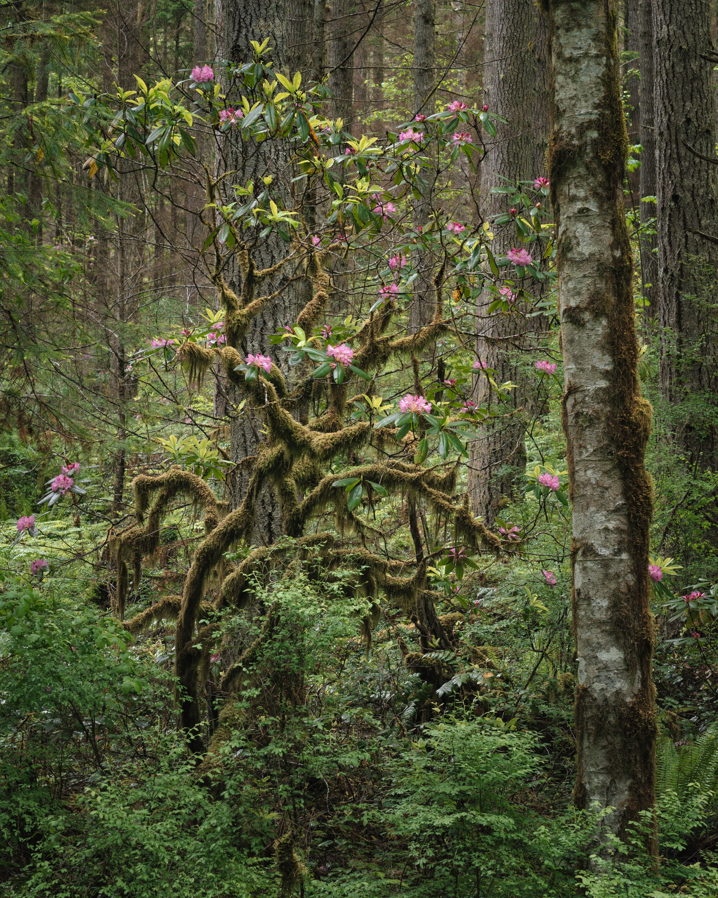
Mount Zion
Although there are some views through the trees towards the top of this peak, there are other trails that are better for high alpine scenes. The main draw of this trail is the rhododendron blooms on the way up for a short time each year. I visited in early June and it was still a little early for blooms on the trail itself—although there were tons of rhododendron plants, so I do think it’s worth coming back to in mid to late June. Even so, I found lots of blooming rhododendrons along the forest road on the drive up to the trail and was able to find plenty of spots to park and get out.


Dungeness Spit
The parking lot requires an entrance fee, but the same national parks pass that works for Olympic National Park works too. There’s a surprisingly nice forest on the walk down at the beach with some decent options for photography, especially on a foggy day. There are lots of birds here, so if you’re at all interested in that, make sure to bring a long lens. The spit is over five miles long, with a lighthouse at the end, so that might be a nice option for true lighthouse fans if you’re willing to walk that far, but I personally haven’t done the full trail yet.


Deer Park and Blue Mountain
Hurricane Ridge gets all the attention, but this road also takes you up into the high elevation parts of Olympic National Park. It’s a windy, steep dirt road, only open during the summer and fall months, that has some sheer drop-offs. Most cars should make it just fine. Just take it slow. There’s a campground at the top and some great hikes leaving from the area. Blue Mountain is a short walk and has fantastic views in all directions.


